Top 5 AI Location Intelligence Tools
Unlock the valuable details hiding in your maps with AI location intelligence tools. They not only automate data extraction and analysis but also predict the outcomes. Use them to uncover location data and consumer behavior. AI location tools will help you make informed decisions for your business.
Are you confused about expanding your business in a new city? Or are you struggling with finding the perfect routes for your delivery service? Worry not. AI location intelligence can help you with that and more. They are among the must-have AI tools for businesses. The Location Intelligence market is expected to reach USD 66.5B by 2032. It would make a CAGR of 15.6% from 2023 to 2032.
A location intelligence tool tells about the demographics, customer behavior, traffic flow, etc., of an area. This valuable detail can help businesses refine their marketing efforts.
So, if caught in a site-specific decision dilemma, you have landed right. In this article, we have discussed the top five AI location Intelligence tools. Read and learn to use the spatial data to improve your business.
What Is AI Location Intelligence?
Location intelligence involves analyzing the geospatial data of a region. The professionals use the data to derive actionable insights and make informed decisions.
AI in location intelligence has further enhanced the efficiency of the technology. Advanced AI algorithms can identify trends and patterns in spatial data. It can then make valuable predictions based on the data.
For example, the location-based AI tools can give details about
- Demographics of your potential customer.
- Infrastructural and environmental data for site selection.
- Traffic flows, transportation routes, footfall traffic, and more.
- These data-driven insights can help businesses overcome a lot of challenges. It can help companies identify target audiences, evaluate risks, and optimize operations.
Top 5 AI Location Intelligence Tools
Following is the list of the best 5 AI location Intelligence tools.
1. Placer.ai
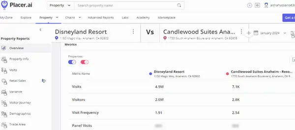
It is first on the list of AI location Intelligence tools. Let's have a look at what Placer.ai offers.
What is Placer.ai?
Picture this.
You are a real estate investor sifting through an endless list of properties. You are looking for a commercial location with untapped business potential. But the lack of relevant data is making you uncertain and indecisive.
It is where the Placer.ai location intelligence steps in.
Placer ai is a start-up that analyses the foot traffic of a location. It also studies demographics and consumer behavior in malls, stores, etc.
Businesses can use this information to identify target audiences and optimize reach. They can also use the location analytics platform for site selection.
The process of site selection is crucial for any business. It involves the expertise of analysts, engineers, and construction gurus.
The data types that support the selection of a physical venue are
- Footfall analysis
- Demographic data of the population
- Psychographic data of the consumers
- The spending behavior of the customer
- Area analysis for climate, crime rates, etc.
The Placer.ai location tool provides insights into all the abovementioned data types.
 ThinkML Contributor
Working Method of Placer.ai
The Placer.ai works by collecting geolocation data from users' devices.
A point of interest is drawn in the AI location intelligence platform. When a mobile user spends over 2 minutes within that geographic radius, it is counted as a movement.
After the counts meet a privacy threshold, the movements are clustered into
- Footfall trends
- Demographic trends
The AI location tool maintains the anonymity of the users. It does not reveal the user's identity during data collection.
Placer.ai Features
It is used by over 3000 customers to date. The AI location intelligence platform initially targeted real estate. However, it currently has clients in retail, finance, and more.
In 2022, placer.ai gathered $100 in series C funding at a $1 billion valuation.
Following are a few unique features of the AI tool.
Customer Visitation
It reveals the consumers' foot traffic and dwell time. You can also filter the visitation data by the time, day, and week. The location tool further tells how different seasons impact footfall.
Trade Areas
The trade area feature is a literal lifesaver for professionals. It lets them pinpoint the areas where the potential visitors live and work. So they can focus their marketing efforts on the ideal customer.
Customer Insight
Customer insights give you details about your ideal clients. You can know their
- Demographics
- Income
- Gender
- Favorite eating/shopping spots, etc.
This information can be used to maximize the interest and engagement of the consumer.
Competitive Benchmarking
The AI location tool also lets you compare your performance against the competitors. It is helpful when analyzing regional dominance.
Area Analysis
This feature provides data about what is happening in the targeted locality. For instance,
- Traffic flow
- Road segments
- Crime rates, etc.
2. NextBillion.ai
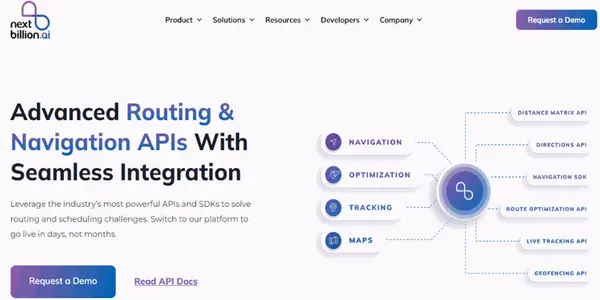
It is another AI location intelligence tool. The platform is designed to help enterprises with complex location problems.
The AI is redefining the way businesses interact with location technology. NextBillion.ai enables enterprises to build and manage their mapping ecosystem.
The spatial data platform has clients across 20 countries since its launch in 2020. It further supports over 15 languages to cater to users around the globe.
Moreover, it garnered over $21 million in a Series B funding round from Mirae Asset Capital.
NextBillion.ai Features
Following are the AI capabilities of the location intelligence tool.
Route Optimization API
The API optimizes the routes for different kinds of vehicles. You can use it to
- Discover the best delivery routes for multi-stop vehicles.
- Find the best paths through unmapped and rough terrain.
- Generate route plans depending on time and traffic.
- Locate the best roads for pick up/drop off and delivery dispatch.
- Build the routes for electric vehicles, etc.
So, The route optimization API will save you time and cost. It will also maximize the efficiency of the supply chain.
Isochrone API
It defines the areas that require equal time or distance to travel around a location. These areas are returned as contours of a polygon. The user can visualize it on a map. Following are the ways you can benefit from it.
- It can help define serviceable areas and accurate ETAs. So, you can use this tool to enhance clients' experience.
- Transportation companies can also use it to optimize schedules.
- Emergency service providers can employ it to refine their response time.
- Real estate investors can use it to know the proximity of other facilities from the property.
Geofence API
Geofence is a virtual boundary created around the digital map. The API allows you to build and manage geofences. Businesses can use this feature to define their area of interest. It would help them to
- Monitor the movement of their potential audience.
- Manage hyperlocal deliveries.
- Track the location of the asset.
- Enhance marketing efforts within the zone of interest
- Optimize ride-hailing business.
Maptiles API
This tool lets you design interactive maps tailored to your business needs. You can build a map with dynamic graphics for visualization. Furthermore, you can easily zoom and switch map layers for a better view. Maptiles API can be used to
- Highlight specific location.
- Track orders.
- Display weather updates, etc.
3. Roam.ai
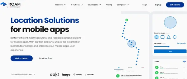
The logistics industry plays a crucial part in the success of a start-up. Businesses can hardly grow with an inept transport system.
Location intelligence has the potential to provide efficient mobility solutions. Roam.ai is one such AI location intelligence platform. It has a wide range of tools that provide
- Real-time geospatial data
- And predictive analysis for making informed business decisions.
We all know businesses are moving to digital platforms for sustainability. It has also increased the need for AI location apps like Roam.ai.
Roam.ai location analytics tool can help a business
- Improve logistics
- Reduce cost
- Better customer experience
Roam.ai Features
Following are the features of the roam AI location platform
Insights API
The Insights API provides valuable details about the users. The API gathers location data from the users who agreed to share it. It can help businesses
- Find the home and work location of users.
- Figure out other areas of interest of users.
- Send location-based promotional alerts to the consumers.
- Enhance marketing strategy.
ThinkML Team
Trips API
Trips API is another valuable tool by Roam.ai. It helps the users track and manage their outings. You can employ it to
- Optimize routes for multi-stop trips.
- Get a summary of the visit, including time, distance, etc.
- Receive live location updates.
So, the API is a must-have for
- Ride-hailing
- Delivery
- And fitness apps.
Nearby API
As the name implies, nearby API helps you find the users nearby. It also supports locating the nearest geofences.
The tool gives accurate information using advanced geolocation techniques. Developers can use it to enhance the location-related features of their app.
Nearby API can help users to
- Find the closest driver, courier, etc.
- Trace a relative on a family tracking app.
- Locate a nearby restaurant on a food delivery app.
- Discover nearby stores, gyms, etc.
Geofencing API
It lets the users create a virtual boundary around a region when using a location-based app. Following are the ways the API benefits you.
- The API lets you create geofences of various shapes.
- You can also create boundaries that only specific users can activate
- It further enables you to build time-sensitive geofences.
- Monitor the movement of delivery vehicles within the geofence.
Businesses can use it to track users' behavior. For instance, the time when they enter/exit a geofence. It helps start-ups to optimize the time of promotional alerts.
4. ESRI

Esri is a leading company in AI location intelligence, mapping, and GIS software.
Thousands of global businesses and government officials use it to tackle issues like
- Public health
- Safety
- Climate change
- Social Equity
- Supply chain resilience
- Transportation, etc.
It combines AI with geographic information systems to automate tasks. It not only saves time but also the cost.
Secondly, it can Search the geospatial data for patterns and trends. Then, predict scenarios based on that data.
The location tool can also extract value from images. These dynamic images can help in informed decision-making.
Lastly, you can use it to optimize supply chains and enhance marketing.
Esri Features
Following are the unique capabilities of the Esri location analytics tool.
GeoAI
As the name hints, GeoAI is the fusion of AI and geospatial data. In today's world, GeoAI technology is used to solve problems and grow businesses. GeoAI automates the extraction of information from raw data like text, images, video, etc. This way, it saves both time and cost.
The advanced AI algorithms further detect clusters in the findings to predict outcomes.
So, GeoAI enhances decision-making via automation and forecasting.
Various industries can use the prowess of the location toolin the following ways.
- GeoAI can analyze routes and traffic to make predictions about road accidents. So, it can improve public safety through optimized emergency response.
- Start-ups are using it to enhance site selection, market planning, etc.
- As mentioned earlier, GeoAI can extract data from images. Architects can use it to identify potential risks in a building.
- Foresters can also use the location tool to know about the volume/species of trees.
- It further benefits the agriculture sector by automating manual processes like species detection.
ArcGIS Pro
ArcGIS Pro is a desktop application by Esri. The GIS app offers a variety of tools to manage spatial data. It lets you visualize, analyze, and share data around the world.
The AI-driven ArcGIS system can help with the following.
- Combine data from various sources and make maps.
- Display data in 2D, 3D, and 4D for visualization.
- Analyse data to identify trends and make predictions.
- Maps and data sharing
ThinkML Team
5. Geoblink
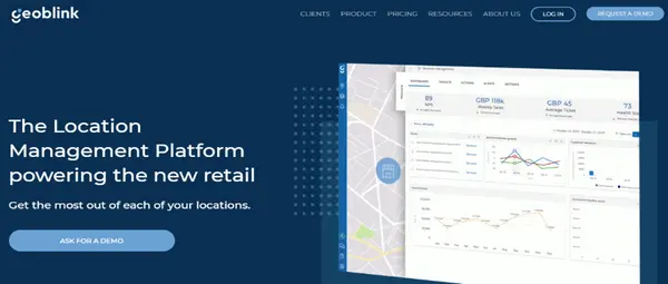
Last on the list of AI location intelligence tools is Geoblink. It helps you get the most out of your location and make informed decisions.
The platform raised $1.1 million in funding the next year of its launch in 2015. Bloomberg mentioned it as one of the most promising start-ups in the world.
Geoblink offers various tools to give insights into location data. It further employs AI and machine learning for efficient data analysis. Then, it rolls out a tailored action plan to enhance your business.
The services of the location management platform are most used by
- Retail: For site selection and finding the right tenant
- Real estate: Identify the best locations for store opening
- FMGC: To enhance product mix strategy and supply chain
Geoblink Features
Redbull, KFC, Pepsico, IKEA, etc., are among Geoblink's prominent clients. Following are its AI location intelligence features.
Data Sources
Geoblink provides access to exclusive data sources forlocation-intelligent insights.
Following are the valuable databases it provides
- Public Profiling: You can use it to find out whether the site is residential or commercial.
- Point of Interest: This database helps you analyze areas' potential.
- Footfall & Road Traffic: It enables you to evaluate a specific road. And discover how the footfall and traffic there would affect your market.
Insights
The insights feature of Geoblink lets you
- Understand consumer behavior and improve the marketing strategy.
- Discover where your customers live, work, or hang out.
- Find the locations with high growth potential.
- Analyze multiple areas side by side to save time.
Geoblink 360
This feature provides you with a 360 vision of your location. You can use it to monitor the performance of your point of sale.
- It helps monitor the visits and sales of your business.
- It further compares your footfall traffic with that of your competitors.
- You can also use it to find out how the location and competition affect the growth.
- The 360 tool can help you optimize the working hours of your sale points.
- You can also employ it to know the demographics of your clients.
- Lastly, it can streamline delivery routes to save time and cost.
Applications of AI Location Intelligence
AI location intelligence has myriad applications across various industries. A few of them are listed below.
Real Estate
You can use AI location analysis tools for site selection. They can perform area analysis to find your desired location. They can also be used to identify the behavior of the ideal consumer in a region. Moreover, the AI location platform can generate 3D interactive maps of the area. All of this can be employed to make an informed decision before investing in a property or land.
Retail
AI location intelligence benefits the retail industry in many ways. Store owners can know the demographics of the customers living or working around. It could help you tailor the marketing strategy. You can also employ geofencing to send promotional alerts when a potential client enters. You can further monitor the in-store behavior of a consumer. And use this data to improve product location. Lastly, it can help you pick the best delivery routes for enhancing the supply chain.
Financial Services
AI location platforms can analyze the area for fraud and crimes. So, it can help banks to optimize the placement of ATMs. It can further make predictions about investing in a specific industry.
Wrap Up
So, these are our recommended top AI location intelligence tools. The tools will optimize the viewing and analysis of geospatial data. They will also help you make data-driven decisions based on your insights. You can use them to revamp marketing efforts. They can further be employed to address pressing issues like climate change, etc. Select a tool that suits you best. And take your start-up to new heights of success.